China launches three commercial remote sensing satellites


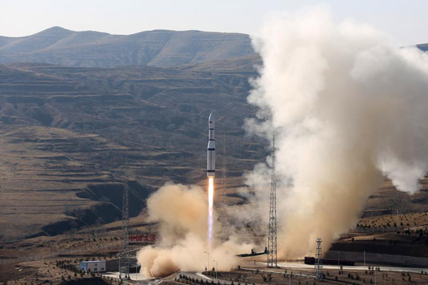 |
| A Long March-6 rocket carries three satellites into space from Taiyuan Satellite Launch Center in North China's Shanxi province, Nov 21, 2017. [Photo/Xinhua] |
TAIYUAN -- China launched three remote sensing satellites at 12:50 pm Tuesday from Taiyuan Satellite Launch Center in North China's Shanxi province.
The three satellites -- Jilin-1 04, Jilin-1 05 and Jilin-1 06 -- carried cameras designed to improve observation capability to promote commercial use for the remote sensing industry.
It was the third launch of the Jilin-1 satellite family, a remote sensing system of more than 60 satellites developed by Chang Guang Satellite Technology Co Ltd.
The system will be used for wide imaging, video imaging and multispectral imaging. Remote sensing data will serve administrations and commercial customers.
Tuesday's satellites were carried by a Long March-6 rocket, a new generation of China's liquid-fueled carrier rocket developed by China Aerospace Science and Technology Corporation.
The launch is the second mission of the Long March-6 and the 255th flight carried out with the Long-March series of carrier rockets.


- Japanese politicians hype up China's defense budget to justify Japan's hidden military expansion ambitions, says PLA spokesman
- Chinese scientists adopt magnetic fluids to treat heart disease
- Mainland facilitates 93 Taiwan compatriots stranded in Middle East to return home via Shanghai
- China to strengthen legal protection for minors involved in civil cases
- Chengdu rapeseed maze draws spring crowds
- Mainland willing to provide Taiwan with reliable energy supplies after reunification: spokesman